Laden...
Fรผge bis zu 3 Produkte hinzu, um sie side-by-side zu vergleichen
Produkte durchsuchenFรผge bis zu 3 Produkte hinzu, um sie side-by-side zu vergleichen
Produkte durchsuchenLaden...

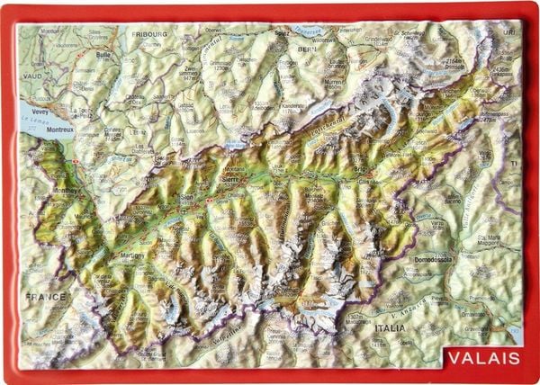
A topographic relief postcard mapping the Valais region using high-precision satellite data. The tactile cardboard surface allows users to feel physical elevation changes like valleys and mountain ranges. It functions as a standard mailing piece while depicting three-dimensional geography.
Nicht verfรผgbar in FR
Verfรผgbar in: CH
Produktbilder

Verfรผgbar bei Orellfuessli.ch
CHF 7.90
| Marke | georelief_vertriebs_gbr |
| Modell | markgraf |
| Breite | 14.8 cm |
| Tiefe | 0.1 cm |
| Hรถhe | 10.5 cm |
| Gewicht | 15 kg |
| Adjustable | Nein |
| Portable | Ja |
| Foldable | Nein |
| Inflation Type | Keine |
| Pump Included | Nein |
| Assembly Required | Nein |
| Preisklasse | Budget |
| Produkttyp | leisure_games |
| Stil | casual |
| Farbfamilie | multicolor |
| Primary Material | wood |
| Wasserabweisend | Nein |
| Weather Resistant | Nein |
| UV Resistant | Nein |
| Intended Terrain | Innen |
| Season Suitability | all_season |
| Group Size | solo |
| Age Group | all_ages |
| Care Instructions | Keep dry and away from direct heat. |
| Storage Requirements | Store in a dry place. |
| Maintenance Frequency | Keine |
| Weather Protection Required | Nein |
| Reinigungsmethode | wipe_clean |